2026 Super El Nino Forecast: What the Latest Models Actually Show
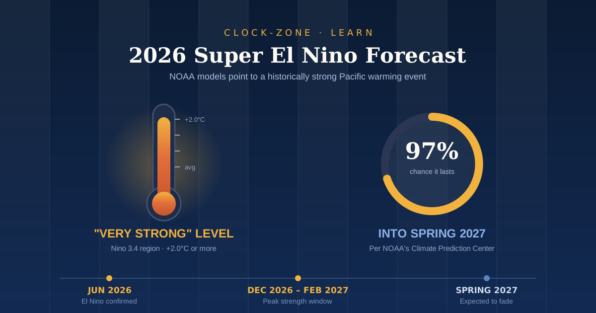
TL;DR: NOAA confirmed El Nino in June 2026 and now puts the odds at 97% that it lasts into early spring 2027. Forecast models point to a very strong event, often called a super El Nino, peaking between late fall 2026 and February 2027. Expect a quieter Atlantic hurricane season, a wetter southern US winter, drought risk across Asia and Africa, and food price pressure into 2027.
The 2026 super El Nino forecast has gone from a maybe to a near certainty in a matter of months. In January, the Pacific was still cooling off after La Nina. By June, NOAA had issued an official El Nino Advisory. By July, every single model run at NOAA's own prediction lab pointed to an event as strong as anything in the past hundred years.
That's a fast flip, and it matters far beyond the weather map.
El Nino is one of the few climate signals forecasters can spot months ahead. That lead time is useful. It tells farmers when to shift planting dates, tells shippers when canal levels may drop, and tells the rest of us when heat, drought, and grocery bills are likely to move.
This guide covers what the current forecast says, how strong the event could get, when it peaks, and what it means where you live. Every number here comes from official agencies or peer-reviewed work, with links so you can check the source yourself.
Is a Super El Nino Really Forecast for 2026?
Yes. NOAA declared El Nino in June 2026 and forecasters put the chance of a "very strong" event, meaning ocean temperatures more than 2.0°C above average, at roughly 63% by winter. That's the level most people mean when they say super El Nino.
The official confirmation came on June 11, when NOAA's National Weather Service announced El Nino had developed in the tropical Pacific and issued an El Nino Advisory.
Since then, confidence has climbed rather than faded. The Climate Prediction Center's latest update states that El Nino will strengthen through the end of the year, with a 97% chance it persists into early spring 2027.
That's about as close to certainty as seasonal forecasting gets. The remaining question isn't whether it happens. It's how big it gets.
What Exactly Counts as a Super El Nino?
A super El Nino is an informal label for sea surface temperatures in the central Pacific running 2.0°C or more above the long term average. NOAA doesn't use the phrase officially. Its own term for the same thing is "very strong."
Here's the scale forecasters actually work with. El Nino is declared when temperatures in a stretch of the Pacific called the Nino 3.4 region sit at least 0.5°C above average. A strong event needs 1.5°C. As Fortune has noted, "super El Nino" isn't official terminology at NOAA or the World Meteorological Organization, but it's widely used in the press for anything past 2.0°C.
Why does the label matter? Because intensity changes behavior. A moderate El Nino nudges the jet stream. A super event can reorganize atmospheric circulation across whole continents.
These are rare. Only five super El Nino events appear in the recorded history up to early 2026. The most recent was the winter of 2015-16, and before that came 1997-98 and 1982-83. AccuWeather notes the 2.0°C threshold has been crossed only a handful of times since 1950.
So roughly once a decade, or less.
How Strong Could the 2026 El Nino Get?
Current model guidance points to a historically strong event. In NOAA's July run, all 30 ensemble members from the GFDL SPEAR system peaked at a strength at least competitive with the strongest events of the past century, which researchers describe as a sign that a historically strong event is underway.
That unanimity is the striking part. Seasonal models usually disagree with each other. When all 30 runs land in the same territory, the signal is unusually clean.
The July forecast also came in warmer than June's, which means the event has been gaining strength faster than expected. Some outlets have gone further. Science News reported the event might become the strongest El Nino on record by the end of 2026.
A word of caution is fair here. Forecast skill is good at this range, but it isn't perfect. Earlier in the spring, NOAA itself noted substantial uncertainty in peak strength, with no single strength category exceeding a 37% chance. Confidence has grown a lot since then, though the exact peak number remains an estimate rather than a promise.
The honest summary: a very strong event is now the clear central expectation, and a record breaker is plausible but not guaranteed.
The 2026-2027 El Nino Timeline
El Nino events follow a fairly predictable calendar. They build through summer and autumn, peak near the turn of the year, then fade through spring. Here's how this one is expected to unfold.
| Period | What forecasters expect |
|---|---|
| Jul to Aug 2026 | Continued strengthening. Atlantic hurricane activity suppressed by rising wind shear. |
| Sep to Nov 2026 | Extreme heat builds across the tropics and subtropics. Drought signals sharpen. |
| Dec 2026 to Feb 2027 | Peak window. Strongest ocean temperatures and the classic El Nino winter pattern. |
| Mar to May 2027 | Gradual weakening, though heat effects linger into spring. |
| Rest of 2027 | Second year effects on global temperature, crops, and prices. |
The European Commission's Joint Research Centre expects extreme heat to build across the tropics and subtropics from September, peaking between December 2026 and February 2027 and persisting into spring 2027.
NOAA's July model guidance agrees on shape, showing the event peaking in late fall or early winter before weakening through winter and into spring.
One practical note. Agency updates land on a fixed schedule, and they publish on US Eastern time. The next Climate Prediction Center discussion is set for August 13, 2026. If you're tracking these from outside North America, a quick check on a world clock saves you refreshing a page at the wrong hour.
What a Super El Nino Means for Weather Where You Live
El Nino doesn't produce the same weather everywhere. It rearranges the atmosphere, and different regions land on different sides of that rearrangement.
North America. During a typical El Nino winter, the Pacific jet stream shifts south, pushing the storm track across the southern tier of the United States. That tends to mean wetter conditions in the south, drier conditions across the Northern Rockies and the Ohio and Tennessee valleys, and a warmer than usual winter across the northern states.
The Atlantic hurricane season. This is the one clear upside. El Nino increases wind shear over the Atlantic, which tears apart developing storms. NOAA's outlook gave a 55% probability of a below average 2026 season. Colorado State University went further in July, forecasting just nine named storms and four hurricanes, which would be the fewest storms since 2014.
Below average is not the same as safe. One landfall in the wrong place still does damage.
Drought risk. The Joint Research Centre flags increased drought risk across large parts of Australia, Southeast Asia, southern Africa, and Central America, with similar risk in the Sahel and the Indian subcontinent as the event intensifies.
Europe. This one is interesting. A strong event may flip Europe's usual pattern, bringing warmer than normal conditions instead of the cooler autumn that often accompanies El Nino, with that warmth building toward spring 2027.
If you work with teams or suppliers in affected regions, a time zone converter makes it easier to schedule the calls that inevitably follow a disrupted harvest or a delayed shipment.
Will This Make 2027 the Hottest Year on Record?
Possibly, and 2027 carries more risk than 2026. An extreme El Nino can add roughly 0.2°C to global average temperature on top of the underlying warming trend, and that effect usually peaks in the year after the event forms.
That lag catches people out. The ocean releases stored heat into the atmosphere gradually, so the temperature record tends to fall in the second year, not the first.
Zero Carbon Analytics estimates an extreme event could add about 0.2°C to the global average on top of climate change, which could push global temperatures past 1.7°C above pre-industrial levels.
The World Meteorological Organization's decadal outlook puts an 86% chance that at least one year between 2026 and 2030 sets a new annual temperature record, and a 91% chance that at least one year passes 1.5°C.
Put simply, this event lands on top of an already warming baseline. That's what makes it different from 1997.
Food Prices, Supply Chains and the Global Economy
The economic tail of a super El Nino is longer than the weather tail. Crops fail in one season, prices move in the next, and supply chains adjust for a year after that.
Crop effects split by commodity. The Joint Research Centre expects durum wheat prices to rise sharply as the event intensifies, with maize increasing slightly, while soybean and hard red winter wheat prices are expected to decline across scenarios. That mix matters, because it means "food inflation" won't hit every aisle equally.
Shipping feels it too. During the 2023 event, drought dropped water levels in the Panama Canal so far that operators cut daily transits from 36 ships to 24, and the Canal Authority is already planning for further changes in 2027.
The headline numbers are large. Research published in Science found the 1997-98 and 2015-16 events caused global income losses of $4.1 trillion and $5.7 trillion. For this event, the Peterson Institute for International Economics estimates a drag on the global economy of somewhere between $700 billion and $3 trillion, with the range depending heavily on how governments respond.
The gap between those two figures is the point. Much of the damage is preventable with early action, which is exactly why a forecast issued months ahead has value.
What to Do With This Forecast
Three things are worth remembering. First, this event is confirmed, not speculative, with a 97% chance of lasting into early spring 2027. Second, the peak window runs from late fall 2026 through February 2027, so the biggest impacts are still ahead. Third, the temperature and price effects usually bite hardest in the second year, which makes 2027 the year to plan for.
Agency updates arrive monthly on a fixed schedule. If tracking them is part of your job, set a reminder rather than relying on headlines.
That's the thinking behind Clock-Zone. We built it so anyone could check world time, convert time zones, or start a countdown timer straight in the browser, with no download and no account. Bookmark the online clock and you'll never miss an update that drops at 8am in another hemisphere.
Frequently Asked Questions
Is the 2026 El Nino officially a super El Nino?
Not officially, because "super El Nino" isn't a term NOAA or the World Meteorological Organization uses. The official category is "very strong," which means ocean temperatures in the Nino 3.4 region running 2.0°C or more above average. Forecasters currently put the odds of reaching that level at roughly 63% by winter.
When will the 2026 El Nino peak?
Most guidance points to a peak between late fall 2026 and February 2027. NOAA's July model runs show strength topping out in late fall or early winter before weakening through the following spring. The European Commission's analysis places peak heat impacts between December 2026 and February 2027.
How does the 2026 event compare to 1997-98 and 2015-16?
It's shaping up to be in the same league or stronger. All 30 members of NOAA's July SPEAR ensemble peaked at a strength at least competitive with the strongest events of the past century. The key difference is the starting point, since this event builds on a much warmer global baseline than 1997.
Will the 2026-27 winter be warmer or colder?
It depends where you are. In a typical El Nino winter, the northern United States runs warmer than usual while the southern states turn wetter as the storm track shifts south. Europe may see a warmer than normal pattern this time, which would be a flip from the cooler autumn El Nino often brings.
How long will this El Nino last?
El Nino events typically last 9 to 12 months. NOAA gives a 97% chance this one persists into early spring 2027, with weakening expected through spring. Knock on effects for temperature, crops, and prices usually continue well past the event itself.
Related Guides
- World Clock: How to Check the Current Time in Any City — for the monthly Climate Prediction Center updates that land on US Eastern time.
- How to Convert Time Between Time Zones Without Mistakes — useful if you're scheduling calls with suppliers in affected regions.
- What Is UTC Time? — the reference agencies like NOAA and the WMO actually publish against.